
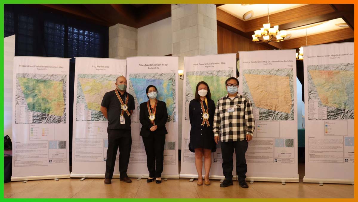
BAGUIO CITY – The Department of Science and Technology (DOST) and the Philippine Institute of Volcanology and Seismology (PHIVOLCS) predicted that the eastern part of the city is prone to intense ground shaking during the occurrence of a strong earthquake dubbed as the ‘big one.’
Engr. Rommel Brutas, DOST-PHIVOLCS representative, stated that based on the results of the city’s ground shaking hazard study, there is a big possibility that there will be intense ground shaking that could result to significant damages that will be inflicted on properties in the eastern part of the city that includes barangays Pacdal, Gibraltar, Lualhati, Loakan Apugan and Happy Hallow.
However, he claimed that the extent of damages that will be inflicted to properties by the intense ground shaking could be mitigated with the conduct of the required geohazard assessment of the area where the structures will be built and are already built aside from ensuring the compliance of the structures to the minimum requirements of the National Building Code and the National Structural code.
The DOST and PHIVOLCS recently turned over to the local government the ground shaking maps which was a product of the Passive Seismic Stratigraphy of Irregular Topography (PSSIT) applicable to mountainous areas of Baguio City that was previously funded by the DOST.
Brutas claimed that now that the ground shaking hazard maps are already in the possession of the local government, it will now be up to the technical people of the concerned offices to implement the recommendations on how to mitigate the damages that will be inflicted and the loss of lives that will be incurred during the occurrence of strong earthquakes.
Because of the results of the said study, the DOST and PHIVOLCS are proposing the construction of earthquake resilient structures in the city to help in mitigating the serious negative impact of intense grown shaking to life and limb.
The said compilation of maps that provide information on the levels of ground motion and site response during the occurrence of strong earthquakes based on the characteristics of the underlying ground soil and rock layers and the effects of specific topography, in this case, mountainous terrain such as the city.

The maps will serve as a significant reference for structural engineers in designing and constructing earthquake resilient buildings and infrastructures in the city to be able to withstand the strong ground movement caused by earthquakes in the future.
DOST and PHIVOLCS technical personnel provided experts with the said maps to allow them to interpret the data that have been made available, identify ground conditions on-site using the publication and estimate the natural vibration of buildings to determine the existing structures that might be vulnerable to intense ground shaking.


